Don’t let the onset of the cooler months dissuade you: nature-lovers will find plenty to discover at Barrington Tops in winter.
Although winter may not be the ideal time for a walk in the Barrington Tops, it’s the conditions this season brings that I really enjoy. This time of year offers an opportunity to photograph an early morning frost or even a covering of snow.
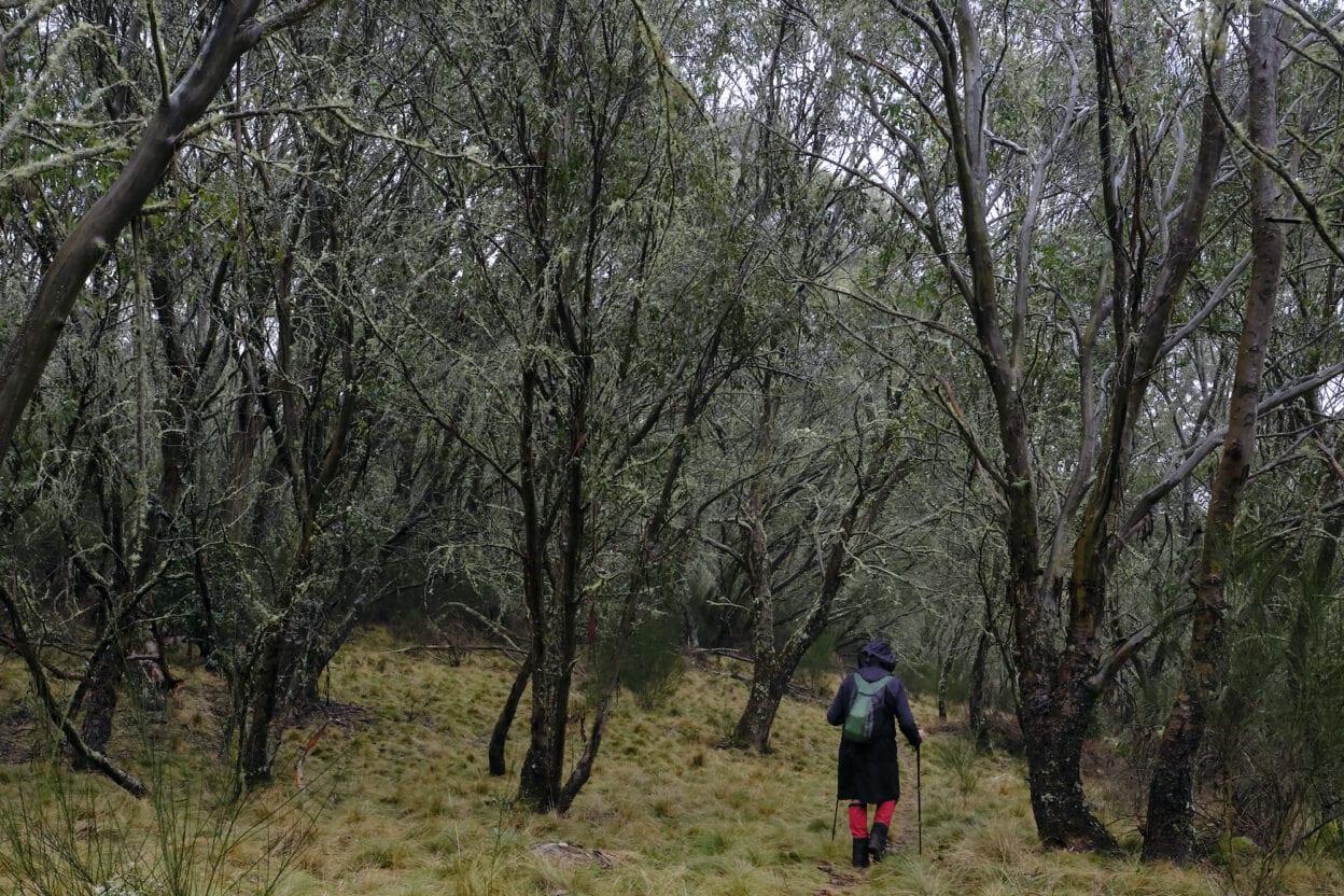
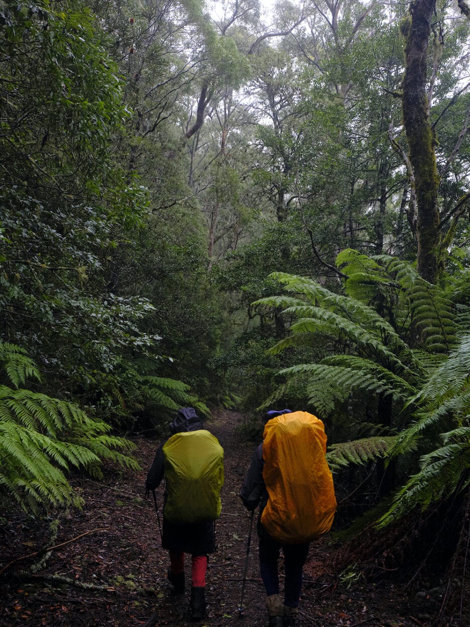
Following a two-hour drive, my two bushwalking friends and I parked at Lagoon Pinch, the starting point for a three-day hike into the Barrington Tops. We were walking by 10:30am and slowly headed up the steep incline of the Corker Track. The morning mist amongst the tall trees of the beech forest added a lovely mountain atmosphere to the hike, enhanced by the eerie calls of currawongs in the distance.
We were surrounded by mist and trees until about lunchtime when a break in the vegetation and the lifting of the mist offered a majestic view over to Careys Peak, which was our goal for the next day.
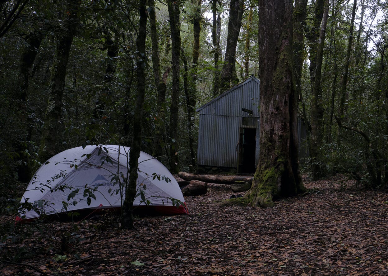
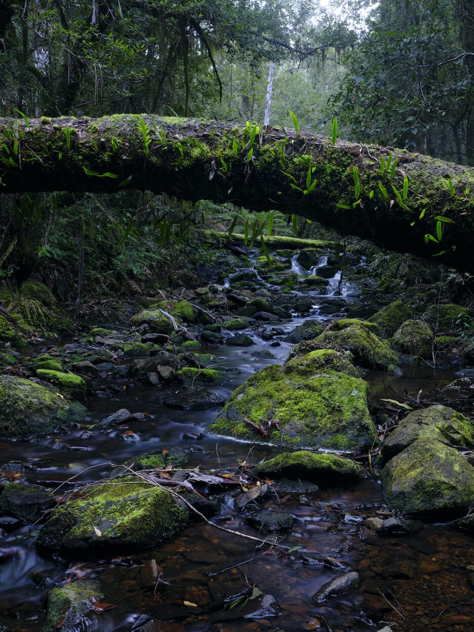
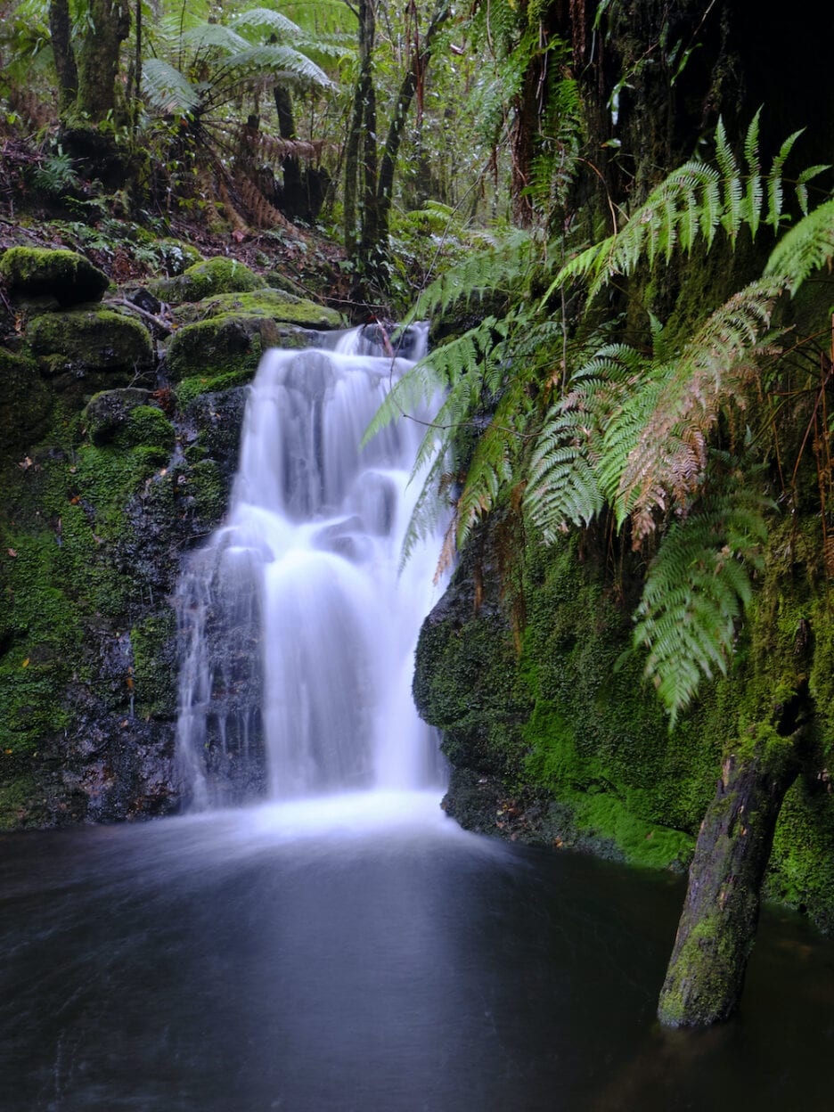
As we reached the top of the Corker Track and it started to level out, we kept our eye out for a special dead tree marking the slightly hidden track to Selby Alley Hut. It felt magical as we followed this secret path through dense forest, and then spotted the hut sitting just across from a beautiful stream that was softly meandering through subtropical rainforest past the building to nearby Basden Falls. We arrived at the hut mid-afternoon, giving us plenty of time to set up our tents and collect firewood. The structure allowed us to cook in shelter and dine near the warm glow of an open fire.
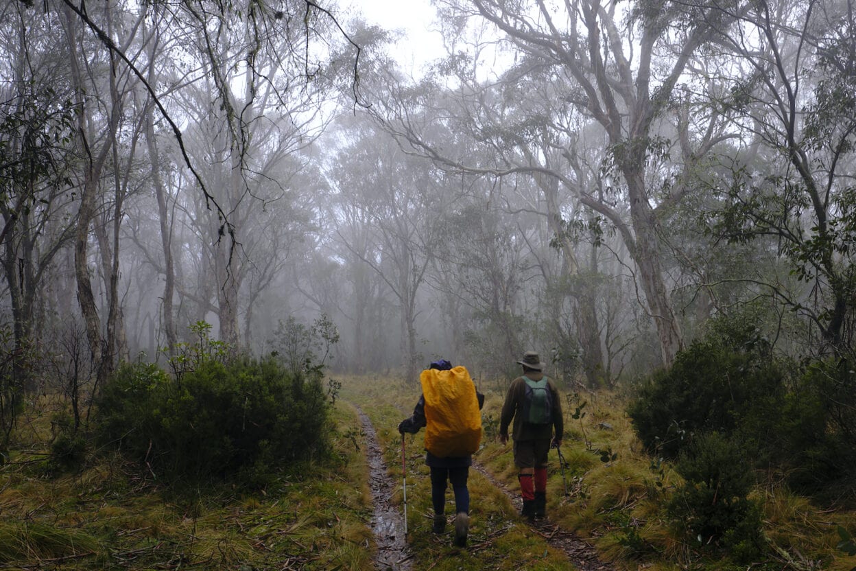
One of the reasons I like this walk is you can set up a basecamp at the hut, giving you a full day to explore the beauty of the Barrington Tops and return back to it in the afternoon. It was with this in mind that we set off the next day, gentle rain and mist adding a real alpine ambience with the snow gums and moss-covered trees. We passed a large grass-covered meadow known as the Black Swamp then continued along the Corker Track joining up with the Aeroplane Hill trail, named after a plane crash in 1945.
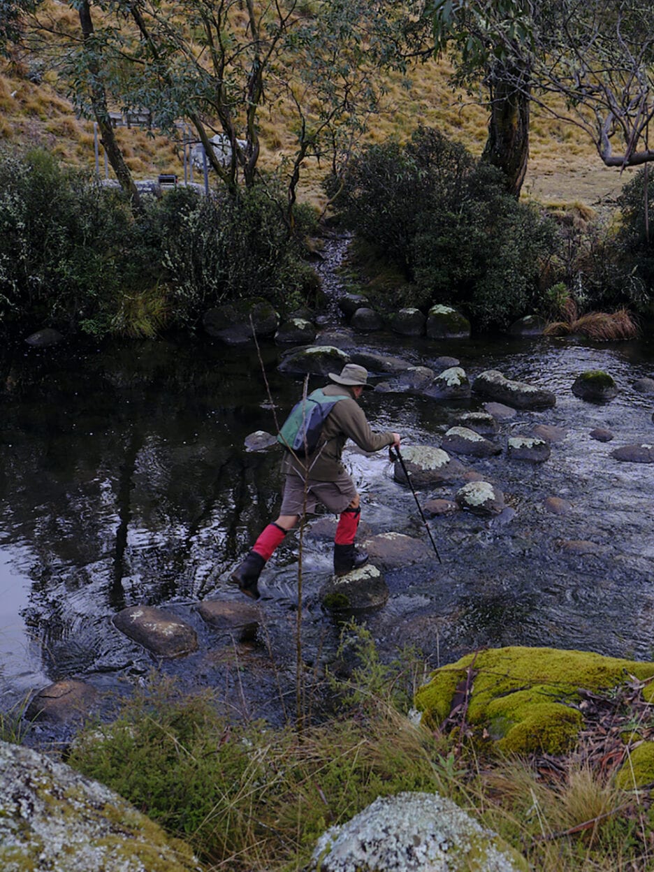
It was then downhill for a while to Junction Pools, a popular camping area in the warmer months, but in winter access is closed to vehicles and we had the area to ourselves. After some creek crossings our route headed west along old forestry trails, eventually swinging around and joining back up with the Corker Track.
Our plan was to stop at Careys Peak lookout, which offers great views over the valleys, but it was shrouded in mist when we arrived.
We got back in time to restock the firewood and as it was raining my friend Greg and I decided to camp in the hut; a bad mistake. During the night, a rat with a liking for plastic carried away several items on its nightly forage, including my watch which was never to be seen again despite extensive searching. It had also pinched a little torch which was beside my head with the watch and I found it buried in a slot a long way from where I was sleeping. I put an entry in the log book: BEWARE, THE RAT STOLE MY WATCH.
On the last day it was still raining, so we set off early down the Corker Track for the cars and were down the bottom by mid-morning. On the way down, we were serenaded by a magnificent chorus of lyrebirds; one was heard imitating a kookaburra, a cockatoo, a currawong and a whipbird, including the female reply. This is a lovely hike that is becoming one of my regulars, though I am still yet to photograph any snow or frost. Maybe next trip.


